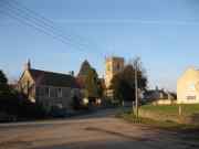
"DOYNTON, a parish in the upper division of the hundred of Langley, in the county of Gloucester. It is situated on the Boyd, a tributary of the river Avon. Two-thirds of the land is in pasture. The village is pleasantly situated on a small plain surrounded by hills. The living is a rectory in the diocese of Gloucester and Bristol, value £433, in the patronage of the lord chancellor. The church is dedicated to the Holy Trinity. The Independents have a chapel. There are several charities, and an endowed free school. William H. G. Langton, Esq., is lord of the manor. On the summit of the hills, overlooking the valley of the Boyd, are entrenchments, supposed to be Roman."
[Description(s) from The National Gazetteer of Great Britain and Ireland (1868) Transcribed by Colin Hinson ©2003]
History
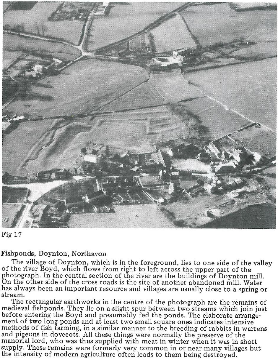
Doynton's history can be traced back to the Domesday Book (1086). This memorial stone was unveiled on 29-10-2000 by Mrs Eileen Pitman, then Doynton's oldest resident aged 99 years old. Click here for an explanation of the Domesday Book entry, in which the village is mentioned as having two mills. One was probably a corn mill and the other a tucking or fulling mill connected with the Cotswold woollen cloth industry. Both these mills were important to the survival of the village and were referred to again in historical records 500 years later. The tuck mill, however, is not mentioned after the middle of the 17th century. The corn mill continued in use until the 1950s marking nine centuries of service to the village.
The Holy Trinity Church (grade II*-listed) is at the centre of the village. As you enter the church you can see a large diamond shaped tablet high on the wall - this is known as a hatchment. It was placed there to honour Sir William Davy - click here to read the detailed history behind it, written by David Vaudrey. The Davy family lived at nearby Tracy Park for over 300 years, you can read more about the history of the park here, written by Richard Kent.
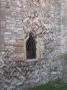
The church was largely rebuilt between 1864 and 1867 but dates back to Saxon times. Its features include 12th century herringbone masonry on the south wall - a style almost unique in this part of the country. It also features a 12th century leper window, again situated in the south wall and the 13th century Lady Chapel. There is a full description of the church, its history as well as lots of information about its many points of interest which can be seen by clicking here and clicking on the blue load button lower on the page.
North-west of the church there is evidence of a group of mediaeval fishponds which provided an important source of food to supplement the diet of villagers in the Middle Ages. Doynton had a rather elaborate group of ponds made by taking water from a stream via a leat (also spelt 'lete' - a man-made watercourse) to a group of rectangular ponds situated in the field.
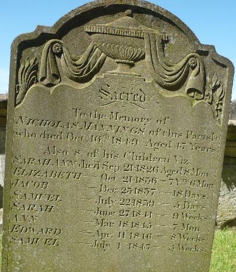
Child mortality was very high in Victorian times - the gravestone below from Doynton church tells a terrible story.
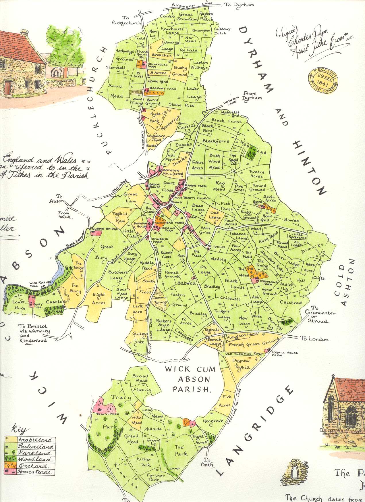
Click here for a map of Doynton from about 1840 showing field boundaries. This map is the first Ordnance Survey Map of Doynton from 1880.
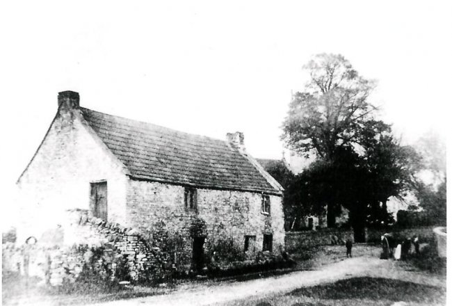
Below is a picture of the Poor House in Doynton from about 1895. Men and women lived separately, there were two entrances - men on the top floor, women on the bottom. Compare the picture from today, top left on this page.
Click here for a link to Doynton census tables giving population and numbers of households etc from 1871 onwards.
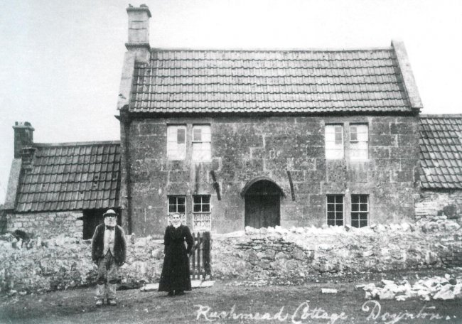
Here is a picture of Harry and Harriet Wright who lived at Rushmead cottage in 1898
Doynton had its own school until 1965, click here and here for pictures of the children from 1921 and 1928.
In the 1990's one of Doynton's oldest residents, Peter Rubery, made a number of charming pen and ink drawings from around the village, click here to see them.
A calendar was created in 2004 which showed a series of interesting photos from Doynton's past, you can see it here.
In 2022 the village celebrated the Queen's Platinum Jubilee with a number of splendid events. Click here to see a slideshow of Doynton Royal Celebrations from previous years.
Previous page: The Consultation Process
Next page: Doynton History Books